Measure any land.From the sky or on foot.
The acreage calculator in your pocket. Draw a field, a yard or a lot on the satellite map, or walk its edge with GPS. Get acres, square feet and every side, then the fence, sod or gravel it takes.
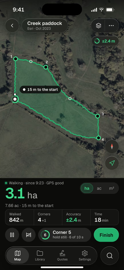
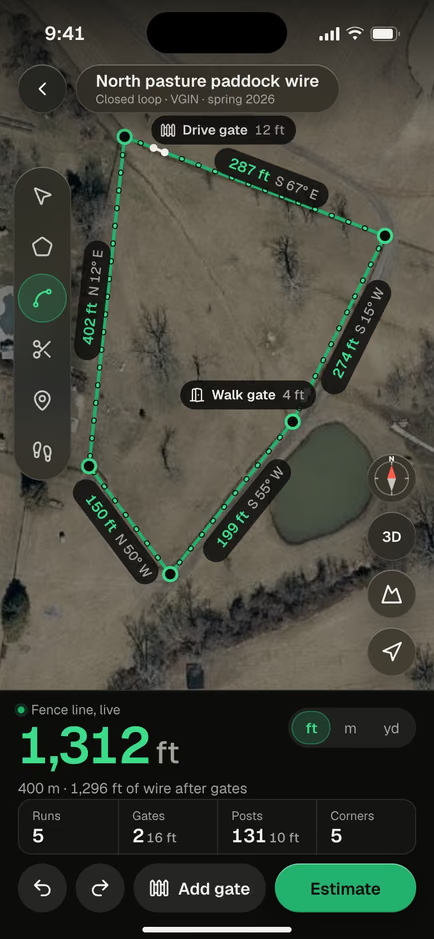
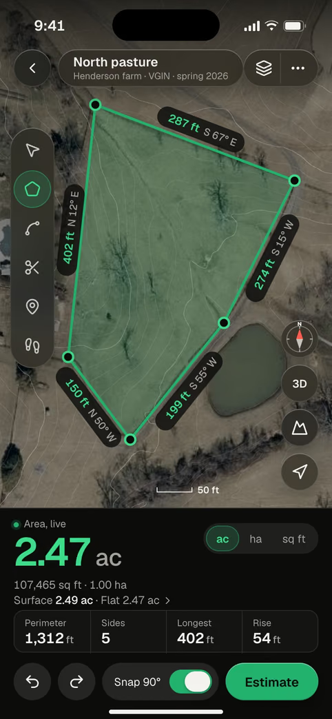
 ±2.4 mWalked with the screen locked1,312 ftFence line, two gates2.47 acNorth pasture, 5 corners

Find it. Draw it or walk it.
Then use the number.
Calculate acreage like a map area calculator, but keep the shape: four steps from an address to an area you can price, print or send.
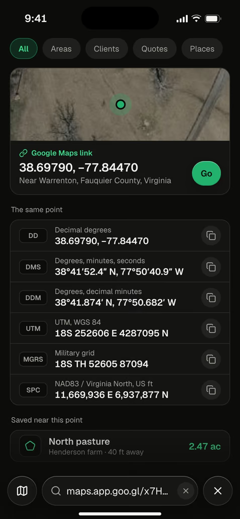
Find the place
Type an address, paste a map link, or enter coordinates in decimal, DMS, UTM or MGRS.
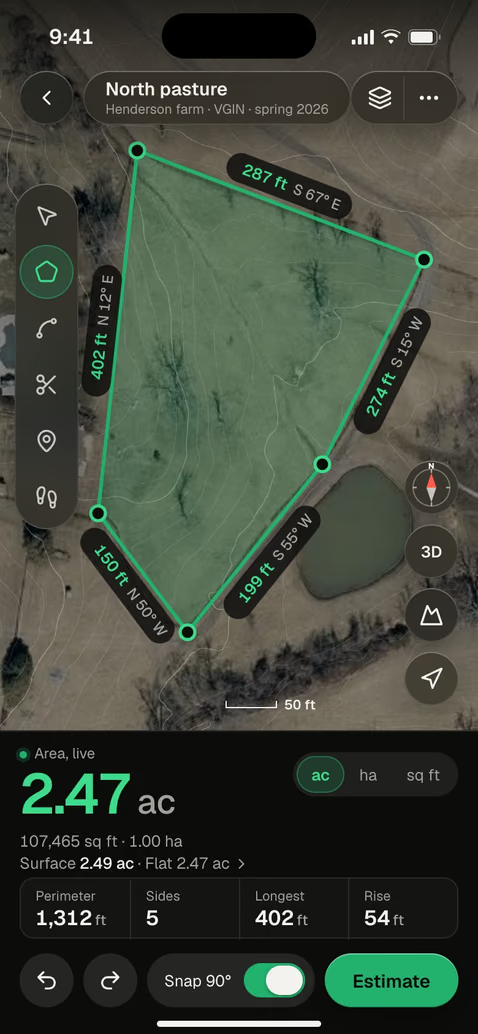
Draw it on the map
Tap the corners. Drag one with the magnifier, or type a side’s exact length.
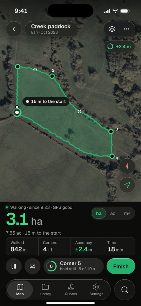
Or walk the edge
Walk or drive the boundary with the screen locked. Each corner is averaged for 10 seconds.
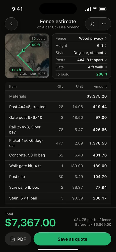
Use the number
Any unit, a PDF with the map, a file for GIS, or an estimate and a quote.
Every acre, measured.
Any way you need it.
Draw it on the satellite map
Tap the corners. Drag one with the magnifier. Tap a side to type its exact length. The area counts up as you go.
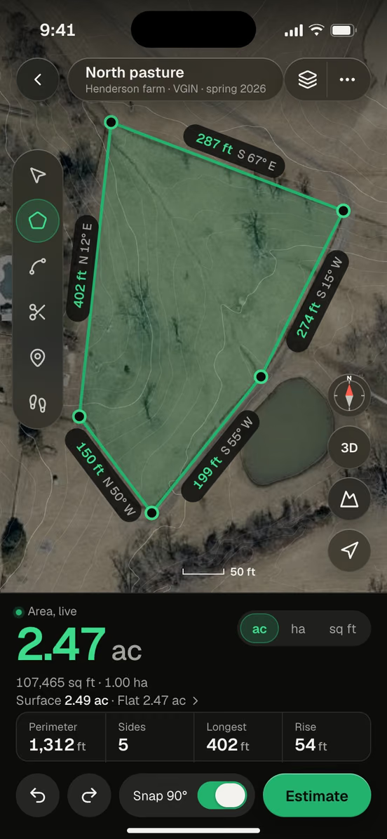
Walk it with GPS
Walk, drive or ride the edge. Corners are averaged over 10 seconds, with the screen locked and a Live Activity.
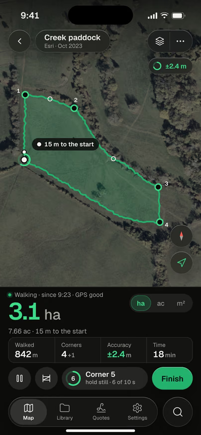
Local units, defined
Acres, hectares and the unit your region uses, with its regional definition.
1.00 ha = 0.41 alqueire paulista = 1.43 manzanas
Every area, kept
Folders for each farm or lease. Synced with iCloud.
The hill counts too
On a slope there is more ground than the map shows. AreaPal reads the terrain and gives you both.
Cut out the pond
Ponds, barns and pools come off the total.
Send it in any format
A PDF with the map, or a file for GIS and CAD.
Lines, layers, coordinates.
And the walk goes on in your pocket.
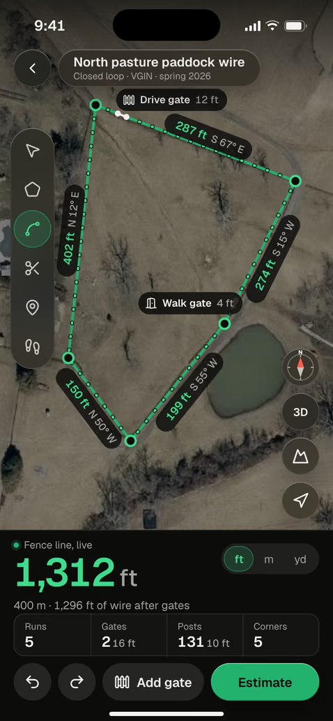
Draw the run, drop the gates. Length, gaps and posts as you go.
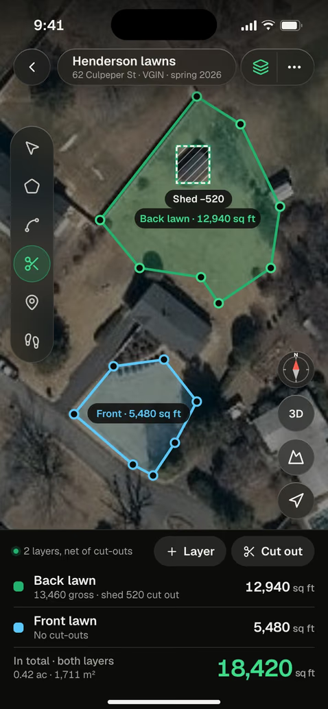
Front and back lawn, the pool cut out. One number for the job.
Paste a pin or type the corners. Your national grid too.
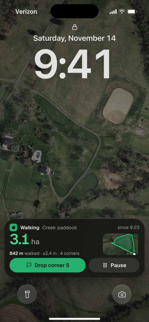
The walk keeps counting on the Lock Screen and in the Dynamic Island.
How close is it?
Depends how you measure.
Every number in AreaPal comes with how it was measured, so you know how far to trust it.
Close enough to plan, buy and price when the corners are clear from above. Trees and shadows can hide one, and the imagery date is on the map.
The app shows the live accuracy and averages each corner for 10 seconds while you stand on it.
The error band comes with the area, on screen and in the PDF. For a legal boundary, hire a licensed surveyor.
Every area, kept.
Sent the way they need it.
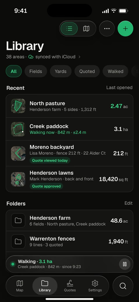
Folders for each farm or client, synced with iCloud. No account.
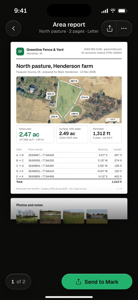
A PDF with the map, the area and each side, ready to print or send.
Send it to GIS, CAD or Google Earth. Bring an old boundary in.
Anyone with land to measure.
And the crews who work on it.
Every field, measured once.
Each field keeps its acres, slope and notes, in the units your county uses.
Your lot, to the square foot.
Before a new lawn, a fence or a listing: the size of the lot and every side.
 $7,367.00Quote 1042 · approved
Quote it from the truck.
Fence, lawn, landscape, paving and roofing crews quote from the truck.
Draw it once.
Price any job from the shape.
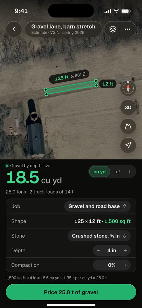
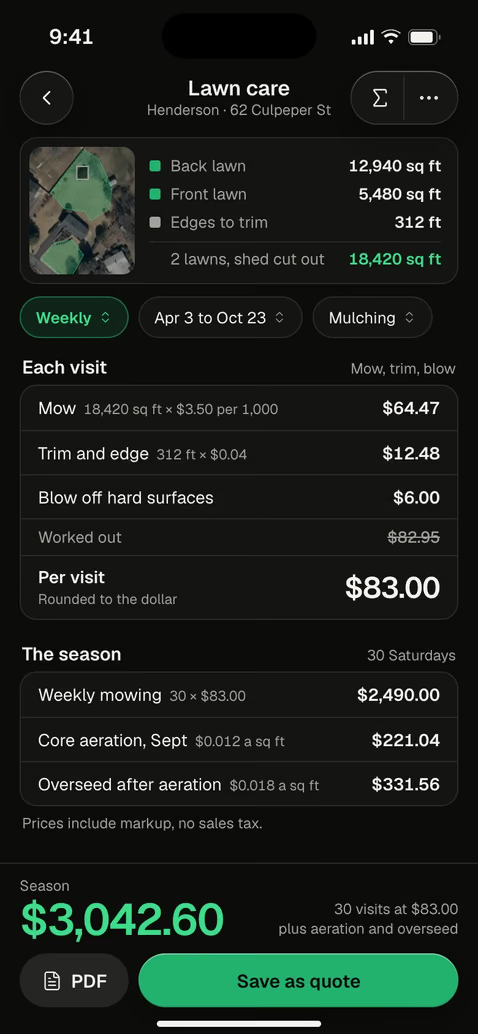
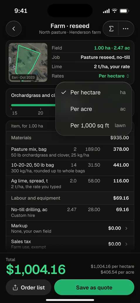
Measure the yard. Price the job.
Get it signed tonight.
Fence, lawn, landscape, paving and roofing companies measure from the truck, build the estimate from their own prices and send a quote the customer approves from a link.
The fence line on the satellite map, from the truck.
Every line from your own price book.
Three options, sent from your phone.
Lisa picks wood privacy and signs with a finger.
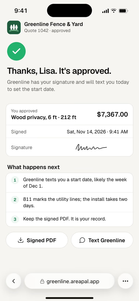
22 Alder Ct, Warrenton · Greenline Fence & Yard
| Materials 30 posts, 477 pickets, gate | $3,375.20 |
| Labor 208 ft + hang gate | $2,120.00 |
| Markup 25% | $1,373.80 |
| Sales tax 7.25% | $498.00 |
| Total | $7,367.00 |
Payment stays between you and your customer.

See every screen
before you download.
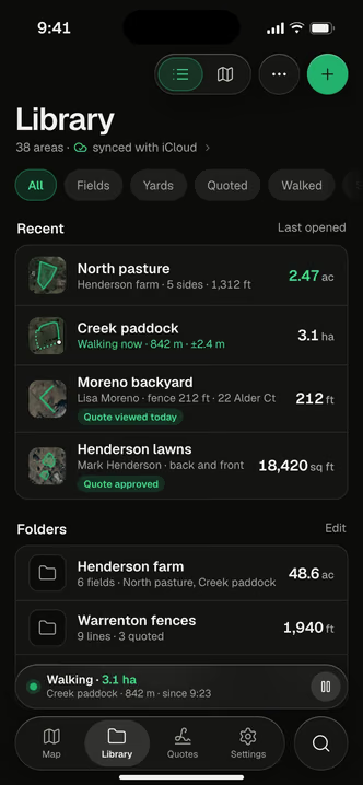
Draw on the mapNorth pasture, 2.47 acWalk the edge3.1 ha so farFence line1,312 ft, two gatesSeveral areasOne total, pool cut out The slopeSurface and flat
 Every unitLocal ones tooCoordinatesAny formatLibraryEvery place, keptArea reportPDF with sizesFence estimate$7,367.00Gravel18.5 cu ydLawn carePer visit, per seasonFarm reseedPer hectare
 QuoteThree options
 What the client seesPick, sign, approveApprovedSigned from a phone
 QuotesWaiting, approved
 ClientsAreas and quotes
 Yard fence212 ft, one gateLock ScreenThe walk keeps going
Acres, square feet, hectares.
Convert them here.


How to measure any land.
With pictures.
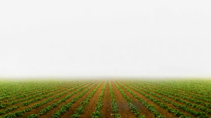
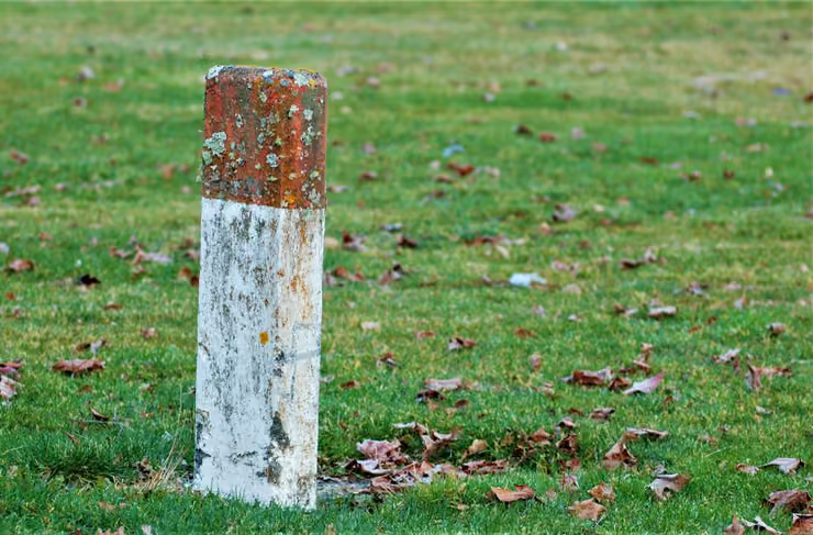
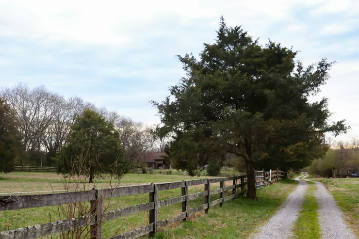
Photos by Clay LeConey, Kerin Gedge, Laura Roberts on Unsplash.
Know your land.
To the last acre.
Draw it, walk it, price it. AreaPal is the measuring wheel that works from the sky.

Questions, answered.
Accuracy
How accurate is measuring on the satellite map?
Close enough to plan, buy and price, when the corners are clear in the imagery. Walking the edge with GPS gives about 2 to 5 m on an iPhone, and the app shows the error band with the area. For a legal boundary, hire a licensed surveyor.
Does a GPS walk keep going with the screen locked?
Yes. Start the walk, lock the iPhone and put it in your pocket. The area keeps counting on the Lock Screen and in the Dynamic Island, and each corner is averaged for 10 seconds while you stand on it.
Maps and GPS
How do I measure acreage on Google Maps?
On a computer, right-click the first corner in Google Maps, choose Measure distance, click around the boundary and back to the first point: Google shows the total area. AreaPal does the same on your iPhone, in acres or square feet, with every side, cut-outs for the house or pond, and the shape saved for later.
Is there an app to measure land area?
AreaPal measures land on iPhone, iPad and Mac. Tap the corners on the satellite map, or walk the edge with GPS, and read the area, the perimeter and the length of every side, in any unit.
Can I open my areas in Google Earth?
Yes. Export an area as KML or KMZ and it opens in Google Earth. AreaPal also exports GeoJSON, GPX, Shapefile, DXF and CSV, and imports KML, KMZ, GPX, GeoJSON and CSV.
Units
How do I calculate acreage?
Measure the length and width in feet, multiply them and divide by 43,560: a 300 by 150 ft lot is 45,000 sq ft, or 1.03 acres. For an irregular plot, tap its corners on the satellite map in AreaPal or walk the edge, and the app calculates the acreage for you.
How many square feet and square yards are in an acre?
One acre is 43,560 square feet, or 4,840 square yards, or about 0.405 hectares. To calculate acreage from square feet, divide by 43,560. AreaPal shows any area in acres, square feet, square yards, hectares or square meters, and in local units such as the alqueire, manzana, guntha and bigha.
How do I find my lot size?
Your deed, plat or the county parcel map gives the recorded lot size. To check it, draw the lot on the satellite map in AreaPal: you get the area in square feet and acres and the length of every side.
For contractors
Do my customers need the app to approve a quote?
No. They get a link, open the quote in any browser, pick an option and sign with a finger. You see when they open it and when they approve.
Can I price a job from my own costs?
Yes. Set your own prices for materials and labor, your markup and your sales tax once. Every estimate then takes its quantities from the measured shape and its prices from your price book.
